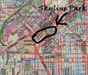
Skyline Park in downtown Denver is a faint green line on a Denver metropolitan street map.
I stood near the corner of 13th and Speer turning my Denver Metropolitan map this way and that, trying to orient it the same way I was looking. The street sign a few yards away said Fox Street, but my map didn’t show it. Skyline Park, my destination, was a thin, short line of green where more than a dozen roads filled a square inch of paper.
I had never been here before. I hadn’t been anywhere in the area that defines Denver’s skyline since I moved to Colorado four years ago. Although I was the only pedestrian in sight, I was sure that if I walked a little way up 13th, others would soon join me on their way to the Handmade in Colorado Expo in Skyline Park.
On Foot, Looking for Art
It was late Friday morning, September 25, the first day of the three-day art festival. After completing errands in the Cherry Creek District, I had headed north on Speer Boulevard for the heart of downtown. Sooner than I expected, the sign for 13th appeared – and there was a parking lot with space available right at the corner. I knew that Skyline Park wasn’t far from where 13th Street intersected Speer Boulevard. I pulled in, relieved to find parking so easily. No matter the $10 daily parking fee.
With my car locked and my packages from Cherry Creek hidden in the trunk, I had set out alone, on foot, map in hand.
Shortly I came to Elati Street and checked the map. No Elati Street was labeled in that square inch that contained Skyline Park. Not to worry, I thought. If I turned on Elati Street I would surely reach 14th and would soon see signs of the festival along Arapahoe between 15th and 16th.
My confidence began to ebb as I noted that I was alone on the sidewalk. I had expected to see a flow of artisan aficionados like me on their way to the festival.
A car that hadn’t been painted since it came off the assembly line in the 1970s pulled up by the curb and stopped not far from me. The driver, about 40, looked as if he could use a shower, and his knit cap looked in need of cleaning too.
Usually I would have walked quickly in the opposite direction, but today was not a usual day. I leaned over level with his open window and said, “Excuse me. Do you know where Skyline Park is?”
“No, I don’t. Sorry,” he replied.
I thanked him anyway and walked on. Soon I met another woman alone on foot. “Excuse me. Do you know where Skyline Park is?” I asked.
“No, sorry. I don’t have any idea,” she answered. I thanked her anyway also and kept walking on Elati Street.
Denver’s courthouse reflects a piece of the city’s skyline.
Suddenly I found myself in a wide courtyard between two buildings. The one on my left was all glass – Denver’s courthouse; the one on my right was all stone – the detention center. I passed through the courtyard admiring these two beautiful buildings and choosing not to think about the distress that goes on inside of them.
Next I observed a couple in their twenties walking toward me and pushing a little girl in a stroller. He was carrying a generic-looking plastic bag, the kind artisans often use at festivals. My hopes went up.
“Excuse me. Could you please tell me where Skyline Park is?”
They didn’t know. “Look it up for her,” the young woman urged her companion. As he studied his smart phone, I stood quietly, choosing not to say I had a smart phone too but it hadn’t been any help. At last he suggested a route after I crossed Colfax.
“Thank you very much,” I told them. I crossed Colfax but still couldn’t find where I was on the map.
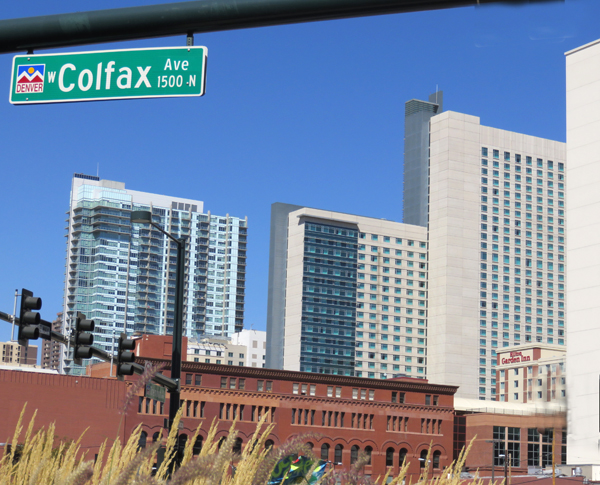
Buildings of varied heights create Denver’s skyline, viewed from Colfax Avenue.
After I had walked several blocks, still confused, I hurried up to a middle-aged couple ahead of me. “Excuse me. Do you know where Skyline Park is?” I inquired.
“Skyline Park?” the woman asked back with a thick German accent. “There is a very nice park just up there,” she offered, pointing up the road to our right. I looked skeptically in the direction of her finger. Then I noticed a tourist’s map of downtown Denver in her hand. We studied it together. Although it was much easier to read than mine, neither of us could figure out where I needed to go. Finally she offered me the map to carry with me.
“Won’t you need it?” I queried, concerned that these European visitors would find themselves lost too.
“Oh, no,” she assured me. “We’re leaving now and our car is in the next block.”
I thanked the couple and continued walking. Eventually I encountered more pedestrians. They looked completely at ease in the city and walked along with relaxed strides. At every intersection I waited for the walk light while others walked past me. They crossed the street as if traffic lights were irrelevant – a mere remnant of a bygone era.
Their nonchalance amazed me, but so did the lack of traffic. Although it was almost noon on a Friday in Denver, on every block I could see more roadway than cars. The streets and sidewalks seemed exceptionally broad, giving the feeling of openness and space in the heart of downtown.
Traffic was light on the streets of downtown Denver at midday on Friday, September 25. It looked as if it were a holiday.
At last I saw a woman in her fifties walking along with an ID badge hanging from a cord around her neck. An employee of a Denver business, I guessed. “Excuse me. Are you familiar with the city?” She was. “Could you please tell me where Skyline Park is?”
“See the clock tower down there?” she asked, pointing to a tall, pointed structure in the distance. I nodded. “Walk over one block to 16th and get on the free shuttle,” she continued. “Take it until you come to the clock tower. Skyline Park is right there.”
Lost No More
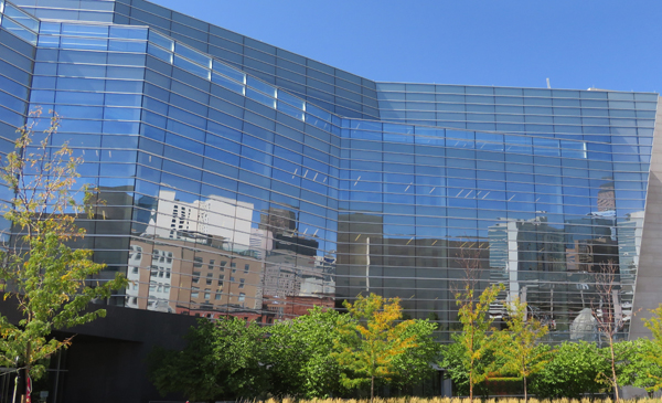
Across from the stop for the shuttle bus, a building with glass walls was reflecting the buildings across from it, creating a picture that was art itself. As far as I could see up and down 16th Street, stone pavers covered its sidewalks and roadways. I had heard of the 16th Street Mall – now I realized that it wasn’t the compact shopping complex I had pictured, but a mile-long pedestrian walkway through the heart of downtown. Only the free shuttles could cruise its length.
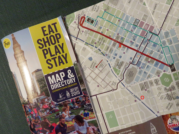
A heavy red line indicates the 16th Street Mall on the map from the Downtown Denver Partnership. The bright red X marks the site of the festival — the bright red O marks where I parked.
Although I had just missed a shuttle, I waited less than five minutes before the next came by. Inside, I found the seat surprisingly uncomfortable and the space confining. Nonetheless, the ride was free and I knew where I was going; so I turned my attention to the scene out the window.
I marveled at how clean the buildings and walkways looked. I had noticed how clean the city was everywhere I had walked that morning. Not one piece of trash had caught my eye. Downtown Denver looked pristine to me.
Then it struck me that I hadn’t noticed any homeless people. Everyone gave the appearance of being relaxed but filled with purpose, even when they were just sitting on one of the numerous benches along the mall. I wondered what innovative measures Denver had put in place to take care of its homeless residents – measures my own city of Fort Collins might use as a model.
Later I found out that a series of ordinances, including an urban camping ban, had made life in Denver difficult for the homeless.
When I finally stepped off the shuttle by the clock tower, I was startled to find little more than a dozen white tents where artisans were awaiting lunchtime shoppers. I looked up and down the street, but no other booths were in sight.
“Is this the Handmade in Colorado Expo?” I asked the artisan in the corner booth. She replied with a smile that it was. Her display of jewelry reminded me of the steampunk jewelry by BeeBull Designs, which I had written about in February. Another booth with fused glass art reminded me of Kathy Dougherty’s work. Beyond that an artisan was selling blown glass similar to the pieces that I had watched Dottie Boscamp make a year ago. I came across a large booth with lovely Peruvian-style jewelry and spotted a man with golden brown skin sitting quietly in a corner. He reminded me so much of Edú Muñoz, an artisan featured in March who also makes lovely jewelry in that style.
I kept wandering and observing. At every booth I said hello and offered an admiring word. I have a lot of respect for the artisans I encounter at festivals. They put their hearts into their work and commit the weekend to putting that work in front of the public. They even have to pay for the weekend space. Sometimes I watch people wander by booths with disinterest and think how I would feel if I had my art on display. That observation makes my respect go even higher.
In spite of my admiration for the artisans and their work, I didn’t find anything that triggered the critical question for this blog: “How did they do that?” After checking all the booths, I pulled out the map the kind woman with the German accent had given me. Now, where exactly was my car?
What a Good Map Can Do
I knew where I was standing – that part was easy. The 16th Street Mall was a heavy red line through the middle of the map. My eyes followed it block by block until I found Skyline Park on Arapahoe Street.
Where exactly had I walked, and where was I when I got on the shuttle? I scanned the map with no answer to either question.
Then I saw it. DENVER JUSTICE CENTER. The letters crossed two city blocks highlighted in gray. That had to be where I had admired the beautiful buildings not far from my car.

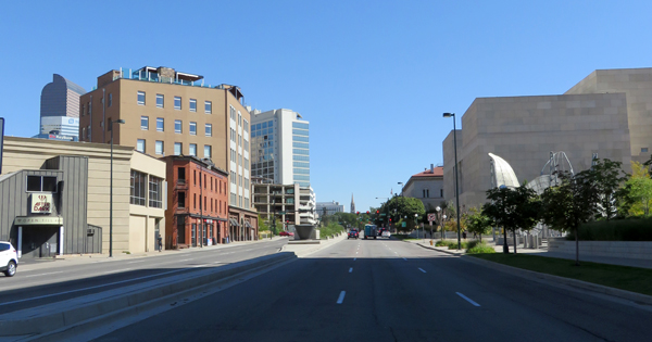
The dome of Colorado’s capitol appears above Civic Center Park in Denver.
I boarded the shuttle again and hopped off at Tremont Place. Three blocks later, I glimpsed the capitol’s dome from Colfax Avenue. Few cars passed by as I took a moment to enjoy the view. Downtown Denver had become surreal to me.
By the time I arrived at my car, I understood why I had been lost. I had pulled off of Speer into the parking lot at 13th Avenue. Had I pulled off at 13th Street, the festival would have been just over three blocks away instead of twelve. (The shuttle had saved me the last five.)
Ironically, the Denver Art Museum was just a few blocks from me on 13th Avenue. I had been there a few months ago, when I was preparing to write about tapestry weaver David Johnson. But I had never approached the museum from this direction. I had let my GPS guide me without understanding where I was going.
Now I treasure my little printed map put out by the Downtown Denver Partnership. I plan to return to explore Denver’s landmarks and to wander again midday along the streets of this clean, relaxed, and lovely downtown area.
Downtown Denver maps are available at information kiosks.